Atmospheric River Soaks Southern California as November 15 Daily Rainfall Records Fall Across the Region
On November 15, 2025, an atmospheric river swept across Southern California, bringing heavy rain to Los Angeles, Ventura and Santa Barbara Counties. The Weather Prediction Center placed Southern California under a Moderate Risk of excessive rainfall that day, expanding the risk area to all of Orange County and far northern San Diego County. A flood watch from the National Weather Service office in Los Angeles/Oxnard covered most of Santa Barbara County, Ventura County, Los Angeles County and the offshore islands through the evening, with rainfall rates up to about one inch per hour possible near thunderstorms and on south-facing foothills and mountains.
At 9:39 a.m., the National Weather Service issued a flash flood warning for the Eaton burn scar and vicinity in central Los Angeles County, in effect until noon: Doppler radar and automated rain gauges indicated heavy rain intensifying over the burn scar, with an expected rainfall rate of 0.5 to 1 inch per hour, and flash flooding and debris flows ongoing or expected to begin shortly, at a "considerable" damage threat level. Locations facing flash flooding included Mount Wilson, Pasadena, Altadena, Sierra Madre, Arcadia and Monrovia. The weather service said debris flows from the burn scar, made up of rock, mud, vegetation and other loose material, would impact drainages, roads and residences in and directly below the burn area.
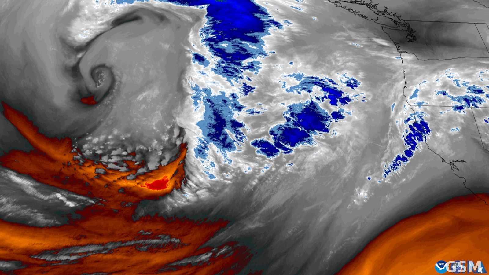
The storm was driven by a strong closed low offshore that drew a plume of tropical moisture into Southern California in the form of an atmospheric river. The Weather Prediction Center said 15-minute rainfall totals of 0.5 to 0.75 inches were observed in the Santa Monica Mountains that morning, that thunderstorms along the Southern California coast could produce maximum rainfall rates of one inch per hour, and that the Transverse Ranges were expected to receive an additional 3 to 5 inches of rain through Sunday morning, with 1 to 2 inches, locally 3 inches, elsewhere.
National Weather Service tallies later showed that numerous stations set daily rainfall records on November 15: downtown Los Angeles recorded 1.65 inches, breaking the old record of 1.64 inches set in 1952; Long Beach Airport recorded 1.34 inches, breaking the 1965 record of 0.74 inches; Burbank Airport recorded 1.71 inches, breaking the 1952 record of 1.62 inches; UCLA recorded 1.72 inches, breaking the 1952 record of 1.10 inches; the National Weather Service station in Oxnard recorded 3.18 inches, breaking the 1934 record of 1.80 inches; Santa Barbara Airport recorded 2.90 inches, breaking the 1952 record of 1.92 inches; and Sandberg, with 2.46 inches, and Camarillo Airport, with 2.78 inches, also set new daily records for their stations.
Source: National Weather Service
Published by GSM · USA (original Chinese edition)
Photo: 图:2025年11月一条大气河流逼近美国西海岸的GOES卫星水汽图(资料图)。GOES影像由科罗拉多州立大学大气研究合作研究所与美国国家海洋和大气管理局提供,公共领域,经Wikimedia Commons。 / Photo: A GOES satellite water-vapor image of an atmospheric river approaching the U.S. West Coast in November 2025 (file image). GOES imagery by CSU/CIRA and NOAA, public domain, via Wikimedia Commons.