Magnitude 7.3 Earthquake Strikes Off Chiapas, Mexico; Tsunami Threat Passes Within Hours
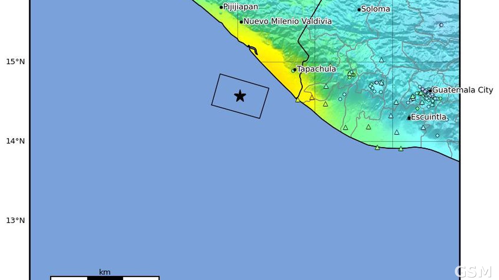
A magnitude 7.3 (Mww) earthquake struck off the coast of Chiapas, Mexico, at 14:48 UTC on July 17, 2026, about 60 kilometers west-southwest of Puerto Madero, at a depth of 22 kilometers, according to the U.S. Geological Survey (event us7000t1bu, centered at 14.571°N, 92.962°W). It was among the strongest earthquakes to hit Mexico in 2026. The USGS PAGER system issued a yellow alert; the event drew 288 felt reports.
After the quake, the Pacific Tsunami Warning Center issued a tsunami threat message for the Pacific coasts of Mexico and Guatemala. A tsunami of about 0.3 meters was measured at Puerto Madero, and by 17:00 UTC the center determined that the threat had largely passed.
Mexican President Claudia Sheinbaum said, after speaking with the governors of Chiapas and Tabasco, that neither state reported major damage or casualties, and Guatemalan President Bernardo Arévalo confirmed there were no deaths in Guatemala. The Associated Press reported at least two people injured in southern Mexico, with civil protection figures running as high as four, along with partial wall and roof collapses, gas leaks, and structural cracks along the Chiapas coast.
Aftershocks continued, including a magnitude 5.5 aftershock in the same offshore area on July 19. Mexico's National Seismological Service (SSN) measured the mainshock at magnitude 7.4, slightly above the USGS figure of 7.3.
Source: U.S. Geological Survey
Published by GSM · USA (original Chinese edition)
Photo: 图:美国地质调查局发布的本次地震 ShakeMap 烈度图,星标为震中,位于墨西哥恰帕斯州塔帕丘拉以西近海。美国地质调查局,公共领域。 / Photo: USGS ShakeMap intensity map for this earthquake; the star marks the epicenter off the coast near Tapachula, Chiapas, Mexico. U.S. Geological Survey, public domain.