Magnitude 6.2 Earthquake Strikes Vanuatu: Epicenter 43 km ESE of Port-Olry, Depth 142.8 km
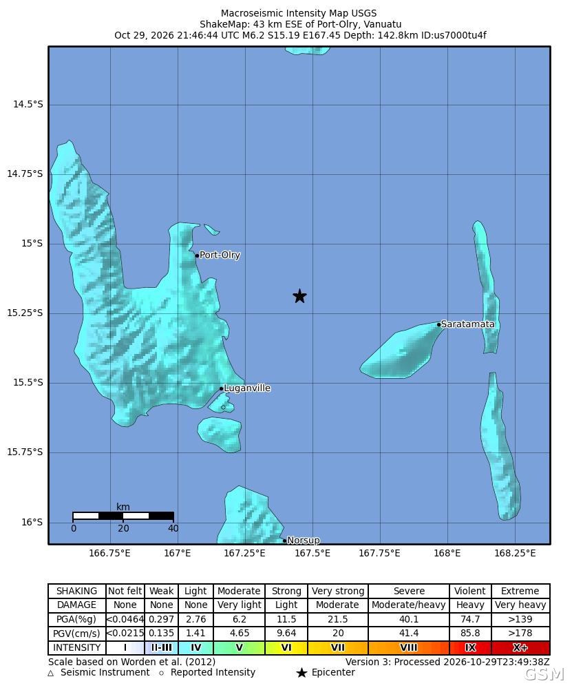
A magnitude 6.2 earthquake struck the South Pacific island nation of Vanuatu at 21:46 UTC on October 29 (08:46 local time on October 30), according to the U.S. Geological Survey (USGS). The epicenter was located 43 kilometers east-southeast of Port-Olry, on the country's largest island, Espiritu Santo, at a depth of 142.8 kilometers.
The USGS put the magnitude at 6.2 (moment magnitude), with the epicenter at 15.19 degrees south latitude and 167.45 degrees east longitude. The event, catalogued as us7000tu4f, has been reviewed by seismologists. The town of Luganville, the island's main settlement, lies southwest of the epicenter.
The USGS assigned the earthquake a green alert level, indicating a low likelihood of casualties and economic losses. The agency received four felt reports, and its ShakeMap shows shaking on land near the epicenter was mostly light, consistent with the quake's depth of more than 140 kilometers. The USGS issued no tsunami alert for this event.
Vanuatu sits on the Pacific Ring of Fire near the boundary of the Australian and Pacific plates, and earthquakes and volcanic activity are frequent. The USGS continues to update its event page with any revised measurements.
Source: GSM · USA (original Chinese edition)
Photo: 图:美国地质调查局(USGS)发布的本次地震震动强度图(ShakeMap),星号为震中,位于Port-Olry东南偏东海域。图片:USGS,公共领域。 / ShakeMap for this earthquake published by the U.S. Geological Survey (USGS); the star marks the epicenter, ESE of Port-Olry. Image: USGS, public domain.