Rains Lift New Mexico's Navajo Reservoir Nearly 60 Feet to Highest Level Since August 2019
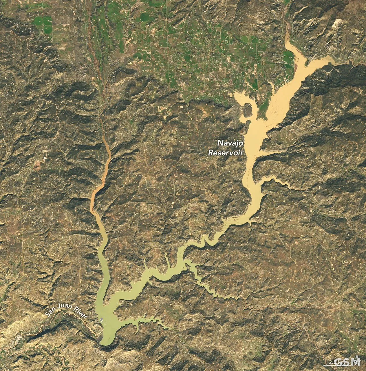
NASA's Earth Observatory released satellite imagery on November 11 showing the water level of Navajo Reservoir, New Mexico's second-largest reservoir, rising rapidly after heavy rains.
Comparison images taken by the Operational Land Imager aboard Landsat 9 on September 20 and November 7 show the reservoir — which straddles northern New Mexico and southern Colorado — rising nearly 60 feet (about 18 meters) over that span. U.S. Army Corps of Engineers data show the reservoir reached its highest level since August 2019 on November 7, at 108 percent of its average capacity for that date, up from just 60 percent on September 20.
Two consecutive rounds of intense rainfall swept the Four Corners region of the U.S. Southwest from late October into early November, sending the San Juan River and other rivers surging. The town of Pagosa Springs, Colorado, was hit especially hard: 5.05 inches of rain fell in the first round, the San Juan River reached major flood stage on October 23, and on November 1 it rose again to near the record level set in 1911.
The U.S. Drought Monitor's November 3 summary noted that short-term drought has ended across the Southwest and the Great Basin.
Source: NASA Earth Observatory
Published by GSM · USA (original Chinese edition)
Photo: 图:纳瓦霍水库2026年11月7日卫星影像,水位升至2019年8月以来最高。NASA Earth Observatory 影像(Michala Garrison 作图,美国地质调查局 Landsat 数据),公共领域。Photo: Navajo Reservoir on Nov. 7, 2026. NASA Earth Observatory image by Michala Garrison, using Landsat data from the U.S. Geological Survey, public domain.