Hurricane Simon Strengthens to Category 4 Off Mexico's Pacific Coast; Landfall Expected Late Saturday or Early Sunday Near Manzanillo–Puerto Vallarta Stretch
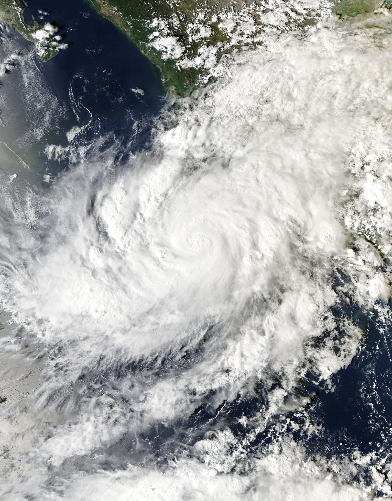
Hurricane Simon strengthened into a Category 4 storm off Mexico's Pacific coast on Saturday, Oct. 10. In its latest Saturday-night update, the U.S. National Hurricane Center reported maximum sustained winds near 155 mph, just shy of Category 5, with its center about 65 miles south-southwest of Manzanillo, moving north at about 5 mph — noticeably closer to shore than earlier in the evening. Simon is expected to make landfall on Mexico's west-central coast on Sunday as a major hurricane, with landfall expected along the Jalisco coast between La Huerta and Tomatlán, and some further strengthening is possible beforehand.
A hurricane warning covers parts of the Pacific coast south of Puerto Vallarta, including the Manzanillo area and the offshore Islas Marías, with a tropical storm watch farther south toward Lázaro Cárdenas. Mexican civil protection authorities suspended nonessential activities and travel from 4 p.m. Saturday in Puerto Vallarta and municipalities across Jalisco, Colima, Michoacán and Nayarit.
The NHC expects 10 to 20 inches of rain across portions of southwestern Mexico through Sunday, with isolated totals up to about 30 inches in parts of Michoacán, Colima and Jalisco — enough to trigger life-threatening flooding and mudslides, especially in mountainous terrain — plus storm surge and destructive waves near and east of the landfall point. AccuWeather meteorologists noted Simon intensified unusually fast, compressing preparation time for coastal communities. The storm follows Hurricane Polo, which hit the Baja California Peninsula as a Category 2 last week.
For GSM readers: Puerto Vallarta and Manzanillo are familiar vacation and cruise destinations for Southern California Chinese; anyone traveling there soon or with family there should monitor the latest NHC and Mexican civil protection bulletins and avoid beaches and low-lying areas during the warning period. What to watch next: the actual landfall location and intensity, port and airport disruptions, and damage and rescue updates.
Published by GSM · USA (original Chinese edition)
Photo: NOAA Aqua 卫星 MODIS 影像(2026-10-09),公有领域(Wikimedia Commons)