Hurricane Trudy Lashes Mexico's Pacific Coast, Set to Weaken Tonight
MEXICO CITY — Hurricane Trudy brought heavy rain and strong winds to parts of Mexico's southwest and west-central regions early on Sunday, October 18, maintaining its strength as it tracked parallel to the country's Pacific coast, Reuters reported.
The U.S. National Hurricane Center (NHC) said Trudy was about 150 miles (240 km) west of Manzanillo, with maximum sustained winds of 105 mph (165 kph) — Category 2 strength — moving northwest at about 10 mph (17 kph). Trudy is forecast to remain near the coast through Sunday evening before weakening rapidly overnight and moving south of Baja California Sur on Monday and Tuesday. "Little change in strength is expected this morning, but rapid weakening is forecast to begin by tonight," the NHC said.
Trudy is expected to bring four to eight inches (10 to 20 cm) of rain, with isolated totals of around 12 inches, across parts of Michoacán, Colima and Jalisco, raising the risk of life-threatening flooding and mudslides in steep terrain. The NHC reiterated warnings of dangerous storm surge and damaging waves along parts of Mexico's Pacific coast. GSM previously reported that Trudy's approach had forced cruise itinerary changes and put coastal areas on alert.
Source: GSM · USA (original Chinese edition)
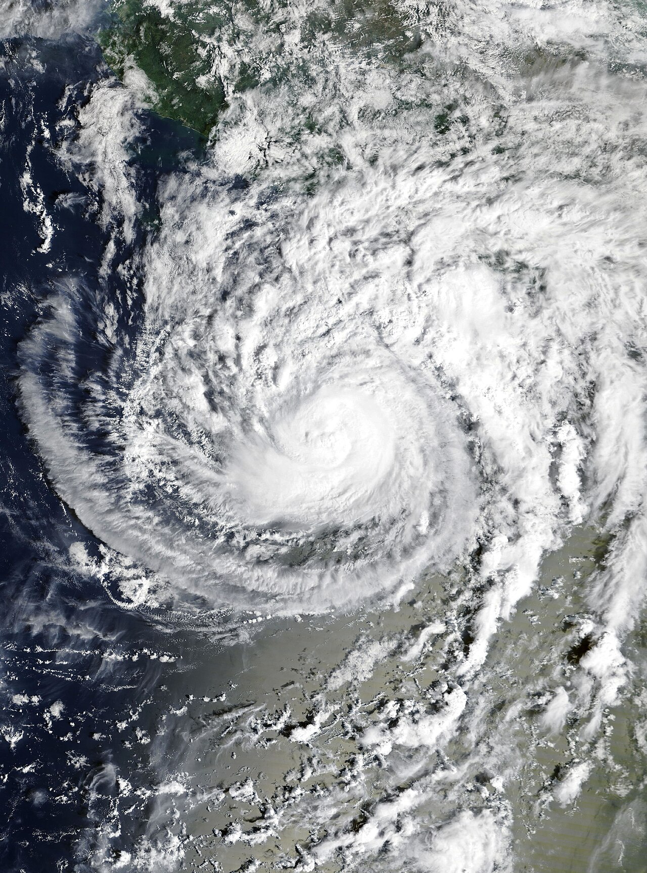
Photo: 飓风 Trudy 的卫星云图(10 月 16 日)。照片:NOAA/Wikimedia Commons(公共领域)。Satellite image of Hurricane Trudy on October 16. Photo: NOAA / Wikimedia Commons (public domain).
- 2026-10-17Hurricane Trudy Nears Mexico's West Coast With 90 mph Winds; Hurricane Conditions Expected Tonight
- 2026-10-17Hurricane Trudy Strengthens Off Mexico's Pacific Coast, Expected to Pass Offshore Without Landfall; Heavy Rain Forecast for Three States
- 2026-10-18Hurricane Trudy Lashes Mexico's Pacific Coast, Set to Weaken TonightThis story
- 2026-10-18Mexico Discontinues All Warnings as Hurricane Trudy Moves Away From the Coast