Nor'easter Bears Down on North Carolina's Outer Banks: Visitors Ordered off Hatteras Island as Coastal Flood Warning Runs Through October 20
Hatteras — Dare County, North Carolina, declared a state of emergency for Hatteras Island effective 6 p.m. on Friday, October 16, and ordered a mandatory evacuation of all visitors beginning at 8 p.m. that evening ahead of a developing coastal nor'easter, The Watchers and local Outer Banks media reported. The order covers the seven villages of Rodanthe, Waves, Salvo, Avon, Buxton, Frisco and Hatteras Village; no evacuation was ordered for island residents or for areas north of Oregon Inlet.
The slow-moving storm is expected to bring days of coastal flooding and ocean overwash. The National Weather Service office in Newport/Morehead City upgraded Hatteras Island from a Coastal Flood Watch to a Coastal Flood Warning early on October 17; the warning runs from 5 p.m. EDT on October 17 to 8 a.m. EDT on October 20, with inundation of 2 to 4 feet above ground level in vulnerable areas and breaking surf of 8 to 14 feet. A High Surf Advisory runs from 2 p.m. on October 17 to 8 a.m. on October 20, and a Wind Advisory from noon on October 17 to 8 p.m. on October 19, with north winds of 30 to 40 mph gusting to 50 mph.
N.C. Highway 12, the island's only road link, is subject to inundation on vulnerable sections around high tide. Emergency officials said the greatest overwash potential begins with the high tide at about 1 p.m. on October 17 and will recur over multiple tidal cycles; because the storm is slow-moving, the highway could remain closed for an extended period, with the length of any closure depending on the storm's duration, the damage done and the work needed to reopen it safely. Officials noted that a mandatory visitor evacuation is an unusual precaution for a nor'easter — such orders are typically reserved for tropical systems and hurricanes — and that during a late-September nor'easter officials had waited until Highway 12 became impassable before restricting access, whereas this time the order came ahead of the worst impacts.
Visitors still on the island were told to take all personal belongings and follow departure instructions from their property management company or accommodations provider; travelers with upcoming reservations were advised to contact their providers to adjust plans and not to travel to the island while the evacuation order remains in effect. The weather service also issued surf and wind advisories for Ocracoke Island and the northern Outer Banks.
Published by GSM · USA (original Chinese edition)
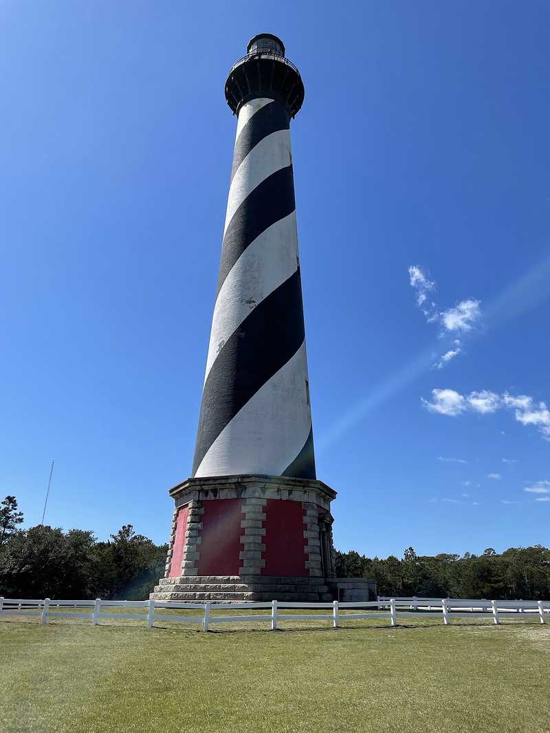
Photo: 图:北卡罗来纳州哈特拉斯角灯塔资料照片。照片:CynthiaCola/Wikimedia Commons(CC BY 4.0)。File photo: Cape Hatteras Lighthouse, North Carolina. Photo: CynthiaCola / Wikimedia Commons (CC BY 4.0).
- 2026-10-17Nor'easter Bears Down on North Carolina's Outer Banks: Visitors Ordered off Hatteras Island as Coastal Flood Warning Runs Through October 20This story
- 2026-10-19Nor'easter Reaches North Carolina's Outer Banks on Sunday: Minor Overwash on Highway 12, Road Stays Open; Worse Flooding Expected Monday and Tuesday
- 2026-10-21Follow-Up: Nor'easter Hits the Outer Banks: NC-12 Closed as Seawater Inundates Rodanthe Neighborhoods
- 2026-10-21Update: Nor'easter Becomes Subtropical Storm Josephine; NC-12 Already Damaged on the Outer Banks
- 2026-10-22Follow-Up: Subtropical Storm Josephine About 195 Miles Southeast of Nantucket: New England Coastal Gusts May Top 50 mph