Follow-up: Lake Tahoe Winter Storm Watch Updated, Snow Above 7,000 Feet Raised to 2 to 4 Feet
The National Weather Service (NWS) office in Reno updated its winter storm watch for the Greater Lake Tahoe Area early on November 16: from late Tuesday night, November 17, through late Thursday night, November 19, elevations above 7,000 feet are now expected to receive 2 to 4 feet of snow, with 1 to 2 feet around lake level and ridgetop winds gusting as high as 80 mph. The figures raise the 2 to 3 feet above 7,000 feet reported on November 15.
In the same update, a winter weather advisory for the Tahoe Basin above 7,000 feet runs until 7 p.m. on November 16, with 3 to 8 inches of snow, up to 2 inches around lake level, and ridgetop gusts to 70 mph. The weather service said travel could be very difficult to impossible, that the Monday morning and evening commutes were already affected, and that the Wednesday commutes could be affected as well.
The southern Sierra was updated in parallel. The NWS office in Hanford kept a winter storm watch in effect for the Sierra Nevada above 5,000 feet from late Tuesday night through late Thursday night: 1 to 2 feet of snow above 5,000 feet, around 4 feet above 8,000 feet, and gusts to 45 mph. An earlier winter weather advisory runs until 4 a.m. Tuesday with up to about 6 inches.
The NWS office in Sacramento has a watch for the Sierra Nevada and southern Cascades above 4,000 feet from Tuesday evening through early Friday morning: 1 to 2 feet above 5,000 feet, up to 3 feet at the highest peaks, and 4 to 8 inches between 4,000 and 5,000 feet. Mountain routes affected include Highway 50, Interstate 80, State Route 4 and State Route 108, with snow-covered roads, travel delays and chain controls all possible.
This is the latest follow-up in GSM's Sierra storm thread: forecasts stood at about 20 inches for high elevations on November 14 and 2 to 3 feet above 7,000 feet at Lake Tahoe on November 15; after the overnight updates on November 16, the Tahoe high-elevation figure stands at 2 to 4 feet, with about 4 feet above 8,000 feet in the southern Sierra, the highest forecast numbers so far for this midweek storm. (Source: National Weather Service)
Source: National Weather Service
Published by GSM · USA (original Chinese edition)
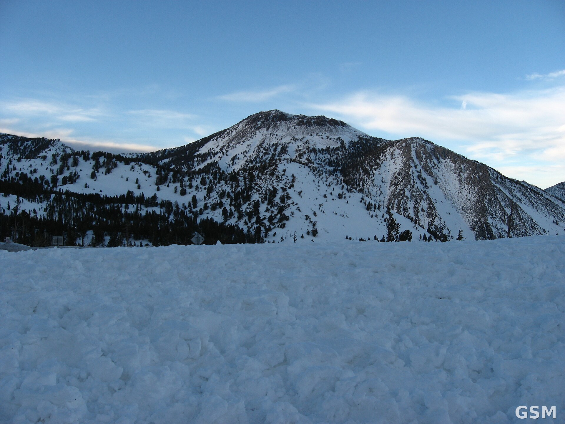
Photo: 图:太浩湖地区 Mount Rose 在一场大雪之后的雪景(资料图)。照片:Ken Lund 摄,CC BY-SA 2.0,经 Wikimedia Commons。 / Photo: Snow-covered Mount Rose near Lake Tahoe after a significant snow storm (file photo). Photo by Ken Lund, CC BY-SA 2.0, via Wikimedia Commons.
- 2026-11-11Winter Storm Watch for the Sierra Nevada: 6 to 12 Inches of Snow Possible Above 6,000 Feet Starting Friday
- 2026-11-12Winter Storm Watch for California's Sierra Nevada: 6 to 12 Inches of Snow Above 6,000 Feet
- 2026-11-12Follow-Up: Winter Storm Warning Issued for the Sierra Nevada, Up to 2 Feet of Snow Above 6,000 Feet Starting Friday
- 2026-11-12The National Weather Service Upgrades Sierra Nevada Winter Storm Watches to Warnings on November 12: About 12 Inches of Snow Above 7,000 Feet Around Lake Tahoe and Ridge Gusts of 70 to 90 Miles an Hour From Friday Morning
- 2026-11-13Follow-up: Winter Storm Warnings in Effect for the Sierra Nevada, With Up to 20 Inches of Snow Near Lake Tahoe and Ridge Gusts of 70 to 90 mph
- 2026-11-14Winter Storm Warning: Up to 20 Inches of Snow Expected Above 6,000 Feet in California's Sierra Nevada
- 2026-11-14Follow-up: Sierra Winter Storm Warning Downgraded to a Winter Weather Advisory; Wednesday System Could Bring Up to 24 Inches at High Elevations
- 2026-11-15Follow-Up: Winter Storm Watch for Lake Tahoe Through Late Thursday Night, 2 to 3 Feet of Snow Possible Above 7,000 Feet
- 2026-11-16Follow-up: Lake Tahoe Winter Storm Watch Updated, Snow Above 7,000 Feet Raised to 2 to 4 FeetThis story