Why the King Tides Broke Records: Los Angeles Harbor Hits All-Time High, Miami Spends Six Days Above Flood Level, Outer Banks Highway Destroyed
Around the full moon of October 26, record-breaking high tides slammed both coasts of the United States at once: Los Angeles Harbor set an all-time record at its gauge, Miami spent a sixth straight day above its moderate-flood threshold, and a coastal highway on North Carolina's Outer Banks was destroyed by ocean overwash while a visitor evacuation order on Hatteras Island remained in force. This was not a single storm. It was a seasonal astronomical high tide stacked with El Niño, warmer-than-normal waters, and onshore winds and surf. Forecasters warned that significant coastal flooding in Southern California would last through Thursday, October 29, and that Florida's highest tide of the event was expected on Tuesday morning, October 27.
1. What a "king tide" is
"King tide" is not a scientific term. The National Oceanic and Atmospheric Administration (NOAA) defines it as a popular name for exceptionally high tides, typically occurring at a new or full moon when the Moon is at perigee, its closest approach to Earth, combined with seasonal factors. Bob Oravec, a meteorologist with the National Weather Service Weather Prediction Center, attributed this event to a stack of factors: the October 26 full moon, warmer-than-normal waters, El Niño, and offshore storms, all pushing seasonal high tides higher. Brian McNoldy, a senior research associate with the University of Miami's Rosenstiel School of Marine, Atmospheric, and Earth Science, added the timing: full moon on October 26, perigee on October 28.
2. West Coast: the Los Angeles Harbor record
California produced the event's sharpest records. At San Pedro in Los Angeles Harbor, the high tide on the morning of October 26 reached a preliminary 8.02 feet — "just above 8 feet," as USA TODAY put it — an all-time record for a gauge whose records date back to November 1923. The previous record was 7.93 feet, set on January 10, 2005. The National Weather Service offices in Los Angeles and San Diego warned that "significant coastal flooding" in Southern California would last through Thursday, October 29, with tides forecast as much as 1.7 feet above normal full-moon predictions, likely raising morning high tides above 8 feet; the morning high tide at La Jolla on October 26 reached at least 7.79 feet.
Orange County's details are more concrete. Newport Beach recorded a high tide of 8.3 feet on October 26, with ocean water flooding low-lying streets on the Balboa Peninsula; the Newport Beach Police Department forecast a tide of 8.5 feet for Tuesday, October 27. Water pumps were activated and sand berms put in place, and the city suspended parking enforcement through Wednesday evening, October 28, so residents could move vehicles out of flood-prone areas. A coastal flood warning for the entire Orange County coastline and a coastal flood advisory for the Los Angeles County coastline both remained in effect until 1 p.m. Thursday, October 29. Forecasters said tides were running about 1 to 1.7 feet above astronomical predictions in Orange County and roughly 1 to 1.5 feet above predictions along the Los Angeles County coastline.
3. Florida: Miami's ten days
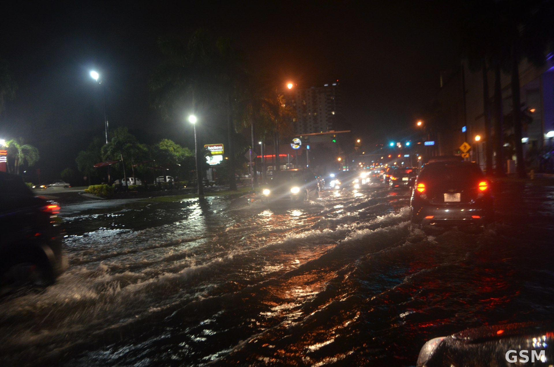
Miami's story is not one day but a streak. As of Monday, October 26, the Virginia Key tide gauge in Miami had exceeded its "moderate flooding" threshold for six consecutive days, McNoldy said. Under the University of Miami's tide forecast model, the streak could reach "an unprecedented 10 days" before water levels retreat, with the highest peak of the event expected at 10:30 a.m. on Tuesday, October 27. The record set on October 25 was the fourth record in five days and the fifth-highest tide ever recorded at the gauge. At Port Canaveral, a high tide was the highest non-tropical-cyclone-related water level ever recorded since the gauge was established in October 1994.
Warnings covered much of Florida's east coast. A coastal flood warning for South Florida (Broward and Miami-Dade) ran from 2:00 a.m. Monday, October 26, through 8:00 p.m. Wednesday, October 28, with gusts to 46 mph and waves of 12 to 15 feet from Palm Beach County through Miami-Dade County. Palm Beach County's warning ran through 8:00 p.m. Wednesday with 8-to-13-foot breaking waves; the Space Coast warning ran through 2:00 a.m. Thursday with 7-to-11-foot breaking waves; the Florida Keys remained under a coastal flood advisory through October 31. Flooding was reported in Fort Lauderdale and Miami Beach.
4. Outer Banks: the highway is gone
North Carolina's Outer Banks suffered the event's heaviest infrastructure damage. The North Carolina Department of Transportation closed Highway 12 between the Marc Basnight Bridge and Rodanthe after waves destroyed about 800 feet of pavement and wiped out nearly 2,000 feet of protective dunes. At the Pea Island Visitor Center, crews were rebuilding more than 1,800 feet of dunes, removing damaged pavement, and grading the roadbed, "but high tide overwash continues to be an issue," the department said. Dare County's noon update on October 23 said overwash at the Pea Island Visitor Center continued through that morning's high tide, with additional pavement damage in the southbound lane, and that there was no confirmed timeline for reopening the closed section.
A mandatory evacuation order for visitors on Hatteras Island remained in effect; visitors were not permitted to enter. The NCDOT Ferry Division began 24-hour emergency ferry service between Stumpy Point and Rodanthe, limited to credentialed permanent residents, property owners, emergency personnel, and critical supply vendors. Governor Josh Stein declared a state of emergency in Dare and Hyde counties and called on the Federal Highway Administration to support immediate repairs and long-term solutions.
This is the second punishing blow to the Outer Banks in less than a month. A strong coastal storm on September 24, 2026, caused significant structural damage to Highway 12 in Dare County, closing it until September 29, when it reopened to northbound traffic only. A second storm on October 16 caused additional damage and again suspended ferry service, and the autumn nor'easter around October 20, followed by Subtropical Storm Josephine, cut the highway again.
5. The baseline underneath the tide
King tides come every year, but the baseline is rising. McNoldy noted that sea level in the Miami area has risen 6.5 inches since the 1983–2001 baseline NOAA uses for tide measurements. Miami-Dade County's own assessment is that sea level rise is causing these tides to happen more frequently, to last longer, and to extend further inland than in the past. Under the City of Miami Beach's 2026 king-tide calendar, based on NOAA's Virginia Key tide tables, the next windows after October 24–30 are November 6–9 and November 23–26.
The official timelines going forward are: significant coastal flooding in Southern California through Thursday, October 29; the San Diego weather service office said one set of models put Halloween-weekend rainfall chances in Southern California at up to 250% of normal, which, stacked on elevated ocean levels, could worsen flooding in vulnerable coastal areas and speed up beach erosion. On the Outer Banks, no reopening timeline has been announced, and Hatteras Island's visitor restrictions remain unchanged.
Related: Follow-Up: Record King Tides Slam Both U.S. Coasts
Source: GSM · USA (original Chinese edition)
Photo: 迈阿密大潮淹水街景,Wikimedia Commons,CC0
- 2026-10-23Newport Beach Declares Local Emergency Ahead of Oct. 26-28 King Tides; Free Sandbags at Three Locations
- 2026-10-24Follow-Up: Coastal Flood Warning Takes Effect Sunday as King Tides Near 8 Feet; Metrolink to Suspend Coast Service Next Week
- 2026-10-25Follow-Up: King Tides Peak Over the Next Three Days in Orange County, With Newport Beach Tides Forecast Up to 8.5 Feet and Three Free Sandbag Sites Open
- 2026-10-26Los Angeles Coastal King Tide Advisory Remains in Effect on October 26: Tides Could Reach 8 Feet, Watch for Water on Low-Lying Beach Roads
- 2026-10-26Record King Tides Slam U.S. Coasts: Los Angeles Harbor Sets All-Time Record as Outer Banks Highway Is Destroyed and Visitors Evacuate
- 2026-10-26Why the King Tides Broke Records: Los Angeles Harbor Hits All-Time High, Miami Spends Six Days Above Flood Level, Outer Banks Highway DestroyedThis story
- 2026-10-27Follow-Up: King Tides Flood Orange County, California, Closing Pacific Coast Highway; Newport Beach Tide Hits Record 8.4 Feet
- 2026-10-29Follow-Up: Coastal Flood Warning for San Diego and Orange County Coasts Runs Through Thursday 1 p.m. as King Tides Run Above Predictions
- 2026-10-31Follow-Up: Huntington Beach Tallies King-Tide Damage at About 114 Buildings, Six Homes Yellow-Tagged